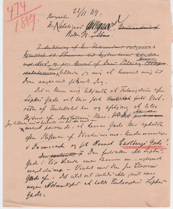
1889.11.22 English
His Excellency Øllgaard,
Mayor, Councillor of State[1]
Sir,
I am taking the liberty to address you in relation to the following issue:
I have been informed that the extension of Lipke Street[2] will be led past the western side of this institute and cut a small corner of the garden of the institute. I that context I permit myself to submit to you, Sir, that it would be most befitting to name this street after the founder of education for the deaf-mute in Denmark, naming it Castberg Street.[3] It does not continue from Lipke Street along a straight line, rather it makes a very obtuse angle in relation to the one from Classen Street. In other words, it would not seem necessary to name the extension Lipke Street. Professor P.A.Castberg was principal of the Royal Institute for the Deaf-Mute from 1807 until his demise in 1823 an institute established by his initiative. At that time the institute was located in the center of Copenhagen, initially in Sølvgade, later on in Stormgade, from where it moved to the present location 50 years ago. Castbergs memory is affectionately preserved in the community of the deaf-mute. It would be a great pleasure for them if his name could be honoured in the way suggested here.
Sir, I would be very pleased if you would kindly attend to this case.
Your obedient servant
RMH
[1] CB: This is a letter to another bigwig of the Danish hierarchy, namely Christian Krarup Øllgaard, 1841- 1915, probably the main person responsible for the gigantic enlargement of the Copenhagen Harbour started around 1870. He was also mayor of Copenhagen from 1885 until 1901. Apparently Mr Øllgaard had a major responsibility in terms of naming the hundreds of new roads created by the huge extension of Copenhagen from 1870 until 1920. This is a handwritten note full of corrections, most likely a rough draft and not sent in this condition. I have transcribed it without the deletions.
[2] CB: Lipke Street is located just north of the Institute for the deaf-mute. The book on the history of street names of Copenhagen says the following about Lipke Street: The portrait painter Alexis Lipke (1819 1885) was among the first persons benefiting when permission was given to parcel out the Classen Garden in 1846. He started a market garden in the area of the street that now carries his name, but in 1880 he parceled it out for urban development. It is rather interesting to note that before 1880 the Institute for the deaf-mute was, in fact, located in the countryside! It was only after 1880 that the big housing blocks just north of the institute were erected ever since then a very affluent residential quarter with large apartments for the growing upper middle class.
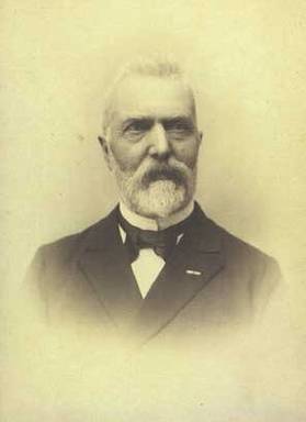
[3] CB: Peter Atke Castberg, 1779 1823, (lived a mere 44 years! And there is a nice statue of him outside the institute on Kastelsvej (Citadel Road)). Castberg was a medical doctor and educationalist for the deaf-mute and has been honoured for his achievements in a district in the area of Valby in the western part of Copenhagen, where streets and roads have been named after Danish scientists. He ventured abroad on study tours in preparation for the establishment of a Danish institute for the deaf-mute, carried out in 1807 with the Royal Institute for the Deaf-Mute in the area of Østerbro in Copenhagen. Castberg is called the Father of Danish education for the deaf-mute. In other words: In the end, no street or road in the area of Østerbro was to be named after Castberg, and unfortunately, as yet, no Malling-Hansen Square. However, at least Castberg had a road named after him. And we in the Rasmus Malling-Hansen Society continue to champion the cause of bringing about a Malling-Hansen Square in Copenhagen!

- Peter Atke Castberg, 1779-1823, the Father of Danish education for the deaf-mute. Copyright: Døvehistorisk Selskab
%EF%B9%94%22%3E%20%EF%BD%9C%20%3C%EA%A4%B7a%3E&md5=ef91f571b63c35d9fe07230052b149a5.html)
- Christian Krarup Øllgaard, 1841-1915, mayor and councillor of state. Photo: The Royal Library
%EF%B9%94%22%3E%20%EF%BD%9C%20%3C%EA%A4%B7a%3E_78c68d8dbbe7dba7.html)

- Two old maps showing the two institutions, for the deaf-mutes and for the blind, and the area around. The first map is from 1869, the second from 1885
%EF%B9%94%22%3E%20%EF%BD%9C%20%3C%EA%A4%B7a%3E&md5=20f3391a761f8255304bd54d42be1d78.html)
%EF%B9%94%22%3E%20%EF%BD%9C%20%3C%EA%A4%B7a%3E&md5=25f8137bc52308667c06b886279197fa.html)